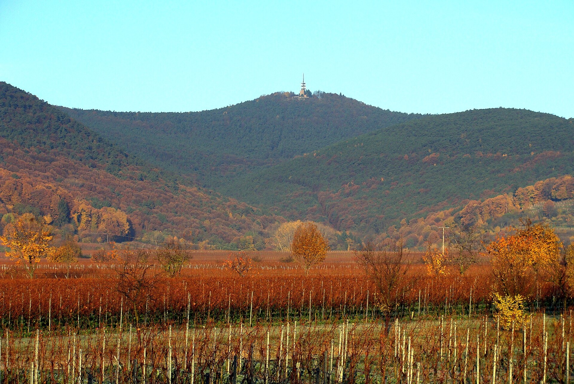
Rheinland-Pfalz·Germany
Pfalzer Weinsteig
Photo © Steffen 962
Duration
7-10 days
Distance
182 km
Elevation gain
5264 m
Max altitude
664 m
The Pfalzer Weinsteig is a 182 km hiking route crossing the Rhineland-Palatinate region in Germany. The trail winds through varied landscapes, combining forests, vineyards, valleys, ridges and caves characteristic of the Palatinate massif. A few lakes complete this remarkable natural setting. This trek offers an authentic immersion into the Palatinate forest massif, rich in natural and viticultural heritage.
SummitsCliffsCavesRidgesLakesForestsVineyardsValleys
Stages
9
days
Overnight accommodation type
46 overnight locations
DifficultyModerate
Duration / day5h45
Distance / day20.2 km
Elev. gain / day+608 m
Hardest stage
3Neustadt an der Weinstraße
26.6 km · +711 m · 7h30| Departure | Arrival | Accommodation on arrival | Profile | Duration | Distance | +Elev. | −Elev. |
|---|---|---|---|---|---|---|---|
1 Bockenheim an der WeinstraßeTown | BattenbergVillage | 5h30 | 19.6 km | +527 m | −386 m | ||
2 BattenbergVillage | Pension Zur SonneLodge | 6h15 | 22.8 km | +499 m | −568 m | ||
3 Pension Zur SonneLodge | Neustadt an der WeinstraßeTown | 7h30 | 26.6 km | +711 m | −785 m | ||
4 Neustadt an der WeinstraßeTown | Wirtshaus Im WolselLodge | 5h30 | 17.1 km | +727 m | −461 m | ||
5 Wirtshaus Im WolselLodge | GleisweilerVillage | 5h30 | 18.6 km | +592 m | −724 m | ||
6 GleisweilerVillage | RambergVillage | 5h30 | 18.5 km | +585 m | −579 m | ||
7 RambergVillage | Ilbesheim bei Landau in der PfalzVillage | 6h45 | 21.7 km | +823 m | −835 m | ||
8 Ilbesheim bei Landau in der PfalzVillage | Pleisweiler-OberhofenVillage | 5h15 | 18.9 km | +512 m | −578 m | ||
9 Pleisweiler-OberhofenVillage | WissembourgTown | — | 5h15 | 18.2 km | +500 m | −499 m |
Elevation profile
How to get there
By car
Similar treks
Explore