Alta Via 1
Photo © Luca Bravo
6-10 days
120.2 km
7027 m
2734 m
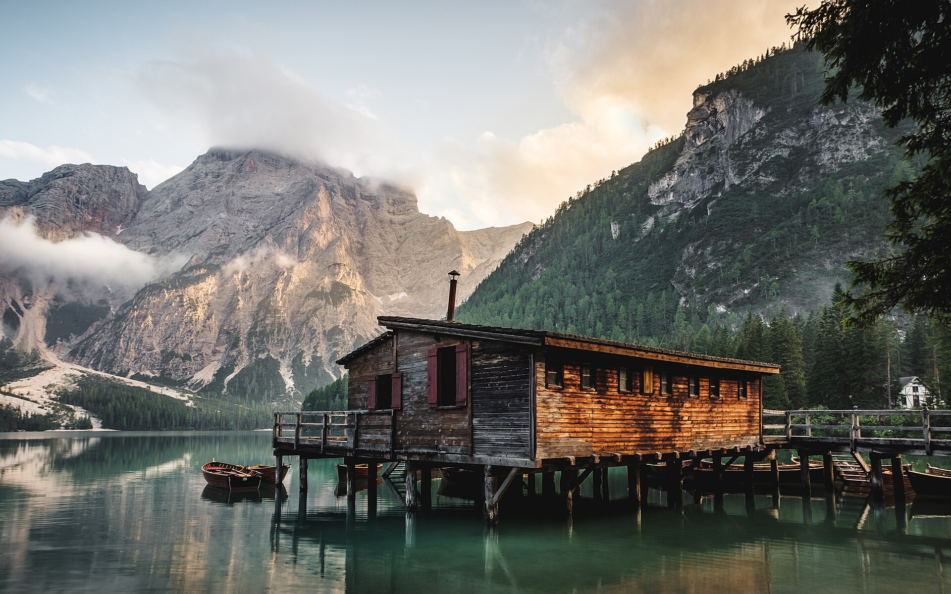
The Alta Via 1 is one of the most famous treks in the Dolomites, Italy. This approximately 120 km hiking route crosses spectacular landscapes of mountains, limestone cliffs, alpine lakes and high-altitude refuges. Accessible to hikers with good physical fitness, it connects Lago di Braies to the Belluno region in 7 to 12 days. Listed as a UNESCO World Heritage Site, it is one of the most beautiful treks in Europe.
Stages
| Departure | Arrival | Accommodation on arrival | Profile | Duration | Distance | +Elev. | −Elev. |
|---|---|---|---|---|---|---|---|
1 Schmieden - FerraraVillage | Üćia de Fodara Vedla - Schutzhütte Fodara Vedla - Rifugio Fodara VedlaRefuge | 4h45 | 12.1 km | +910 m | −493 m | ||
2 Munt de SennesRefuge | Ütia de Scotoni - Scotoni-Hütte - Rifugio ScotoniRefuge | 6h30 | 16.2 km | +1,325 m | −872 m | ||
3 Ütia de Scotoni - Scotoni-Hütte - Rifugio ScotoniRefuge | Rifugio Piezza - Da AurelioRefuge | 6h00 | 16.7 km | +1,041 m | −1,063 m | ||
4 Colle Santa LuciaVillage | Rifugio "Alba Maria De Luca" VeneziaRefuge | 5h15 | 14.9 km | +869 m | −1,304 m | ||
5 Zoppè di CadoreVillage | Rifugio Attilio TissiRefuge | 5h45 | 15.7 km | +1,035 m | −992 m | ||
6 Santa Maria delle GrazieVillage | Rifugio Bruto CarestiatoRefuge | 5h00 | 14.5 km | +750 m | −1,179 m | ||
7 AgordoTown | Rifugio Sommariva al PramperetRefuge | 5h15 | 13 km | +1,039 m | −583 m | ||
8 Rifugio Sommariva al PramperetRefuge | Rifugio Furio BianchetRefuge | — | 3h15 | 12 km | +261 m | −1,779 m |
Elevation profile
How to get there
Public transport
Limited accessThe official starting point of the Alta Via 1 is at Lago di Braies (Pragser Wildsee). From major Italian cities, it is possible to take a train to Dobbiaco (Toblach), then bus 442 to the lake. At the end of the trek, from the La Pissa bus stop, buses connect to Belluno where national rail connections are available. The entire route can therefore be completed without a car.
More informationBy car
Explore