Teton Crest Trail
Photo © GrandTetonNPS
3-4 days
64.2 km
2545 m
3252 m
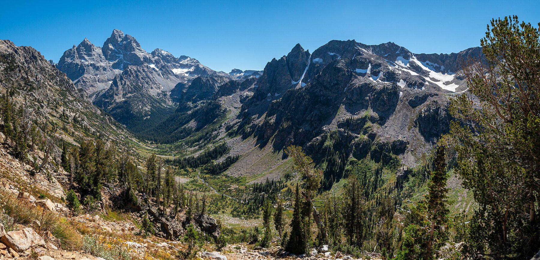
The Teton Crest Trail is a 64 km trek crossing the most spectacular landscapes of the Teton Range in Wyoming. The route winds between rugged peaks, alpine passes, mountain lakes, high-altitude meadows, and vast glacial basins at the heart of the Grand Teton ecosystem. Renowned for its exceptional panoramic views of the iconic Teton peaks, it offers full immersion in one of the most remarkable alpine landscapes in North America. The trail connects Teton Pass to String Lake, passing through a succession of wild scenery among the most celebrated in the American West.
Stages
| Departure | Arrival | Accommodation on arrival | Profile | Duration | Distance | +Elev. | −Elev. |
|---|---|---|---|---|---|---|---|
1 WilsonTown | Middle Fork/South ForkBivouac | 4h45 | 13.3 km | +835 m | −435 m | ||
2 Middle Fork/South ForkBivouac | bivouacBivouac | 5h45 | 18.2 km | +757 m | −563 m | ||
3 bivouacBivouac | campingCamping | 4h15 | 13.6 km | +541 m | −817 m | ||
4 campingCamping | Jenny Lake LodgeHotel | 5h15 | 17.1 km | +602 m | −1,181 m |
Elevation profile
How to get there
Public transport
Fully accessibleThe Teton Crest Trail is accessible without a car thanks to the START Bus network, which connects the town of Jackson to Teton Village, one of the main access points to the trail. Regular buses serve Teton Village from Jackson Hole Airport or downtown Jackson. To reach certain trailheads or to organize a full traverse of the trek, it is generally necessary to complete the journey with a private shuttle or taxi. The national park's official information also outlines the various transport options for accessing the Grand Teton area.
More informationBy car
Explore