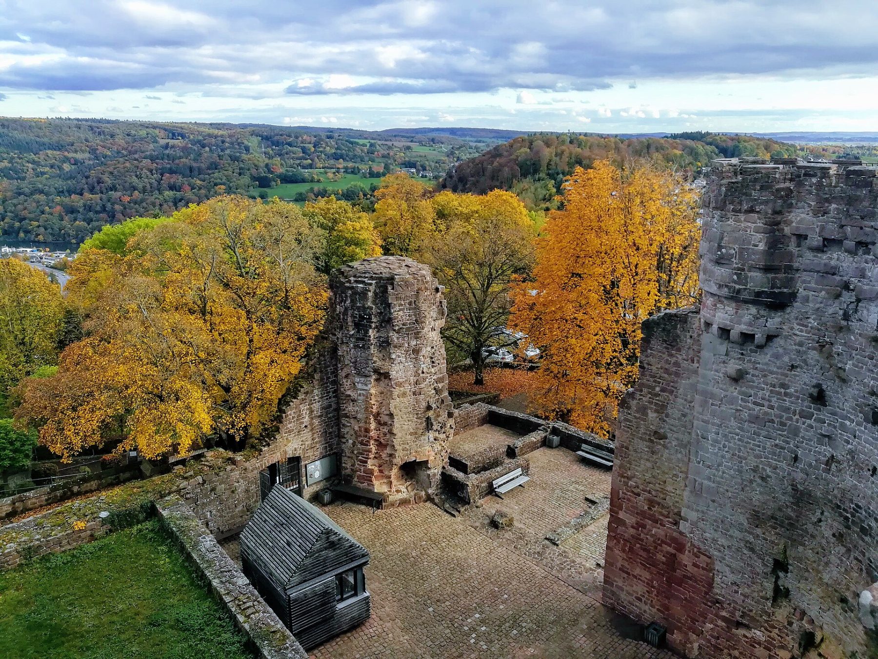
Neckarsteig
Photo © Nemracc
5-7 days
126.3 km
3204 m
572 m
The Neckarsteig is a long-distance hiking route of 128 km connecting Heidelberg to Bad Wimpfen by following the meanders of the Neckar valley. The trail crosses forests of the Odenwald, vineyards, historic villages and numerous castles overlooking the river. Among the iconic sites are Heidelberg Castle, the Dilsberg fortress and Guttenberg Castle. Awarded as a quality trail in Germany, it combines medieval heritage, river landscapes and remarkable panoramas.
Stages
| Departure | Arrival | Accommodation on arrival | Profile | Duration | Distance | +Elev. | −Elev. |
|---|---|---|---|---|---|---|---|
1 Bad WimpfenTown | NeckarzimmernVillage | 6h00 | 21.8 km | +527 m | −410 m | ||
2 NeckarzimmernVillage | LauerskreuzVillage | 5h00 | 17.8 km | +440 m | −533 m | ||
3 LauerskreuzVillage | LindachVillage | 5h45 | 21.5 km | +481 m | −330 m | ||
4 LindachVillage | Hirschhorn (Neckar)Town | 7h30 | 26 km | +762 m | −713 m | ||
5 Hirschhorn (Neckar)Town | NeuhofVillage | 5h00 | 18.3 km | +435 m | −714 m | ||
6 NeuhofVillage | HeidelbergTown | — | 6h45 | 21.1 km | +913 m | −829 m |
Elevation profile
How to get there
Public transport
Fully accessibleThe official starting point is in Heidelberg, easily accessible by long-distance train from the major German cities. The endpoint at Bad Wimpfen also has a railway station connected to the regional rail network. Many intermediate stages are served by the S-Bahn, regional trains and boats operating on the Neckar, making it easy to join or leave the trail without a car. The main localities along the route are directly connected to the public transport network.
By car
Explore