Ahrsteig
Photo © non
4-6 days
104.6 km
2372 m
609 m
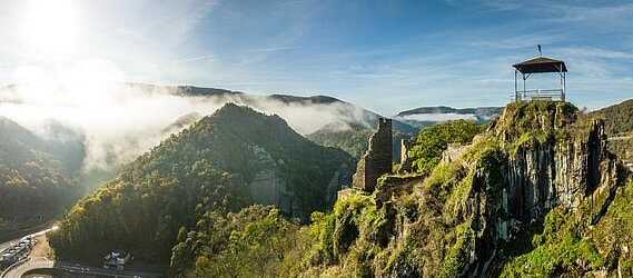
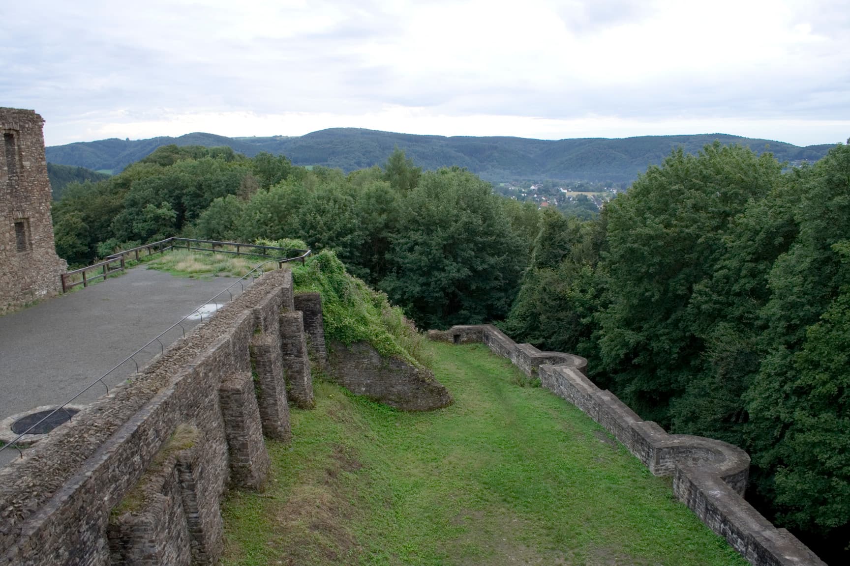
The AhrSteig is an iconic long-distance hiking trail in Germany, covering approximately 104 km through the diverse landscapes of the Ahr valley. The trail winds through terraced vineyards, Eifel forests, rocky ridges and typical wine-growing villages, offering numerous viewpoints over one of the country's most beautiful river valleys. With more than 2,300 m of elevation gain, the route alternates between panoramic sections and passages through unspoiled nature. Hikers also discover ruined castles, spectacular rock formations and the region's renowned viticultural heritage. An unmissable hike for exploring the Rhenish Germany on foot.
Stages
| Departure | Arrival | Accommodation on arrival | Profile | Duration | Distance | +Elev. | −Elev. |
|---|---|---|---|---|---|---|---|
1 BlankenheimerdorfTown | ArembergVillage | 6h00 | 22.2 km | +442 m | −409 m | ||
2 ArembergVillage | DümpelfeldVillage | 5h15 | 19 km | +454 m | −695 m | ||
3 DümpelfeldVillage | AltenahrVillage | 5h30 | 18.8 km | +563 m | −663 m | ||
4 AltenahrVillage | Bad Neuenahr-AhrweilerTown | 6h45 | 22.8 km | +791 m | −780 m | ||
5 Bad Neuenahr-AhrweilerTown | Bad HönningenTown | — | 6h00 | 21.8 km | +466 m | −596 m |
Elevation profile
How to get there
Public transport
Fully accessibleThe AhrSteig is easily accessible by public transport. The terminus at Sinzig is served by train on the Rhine valley line, while Blankenheim is connected by regional bus and train services. Throughout the route, several train stations and bus stops make it easy to join or leave the trail.
By car
Similar treks
Explore