Via Rhenana
Photo © Kabelleger : David Gubler
5-8 days
189.3 km
1067 m
588 m
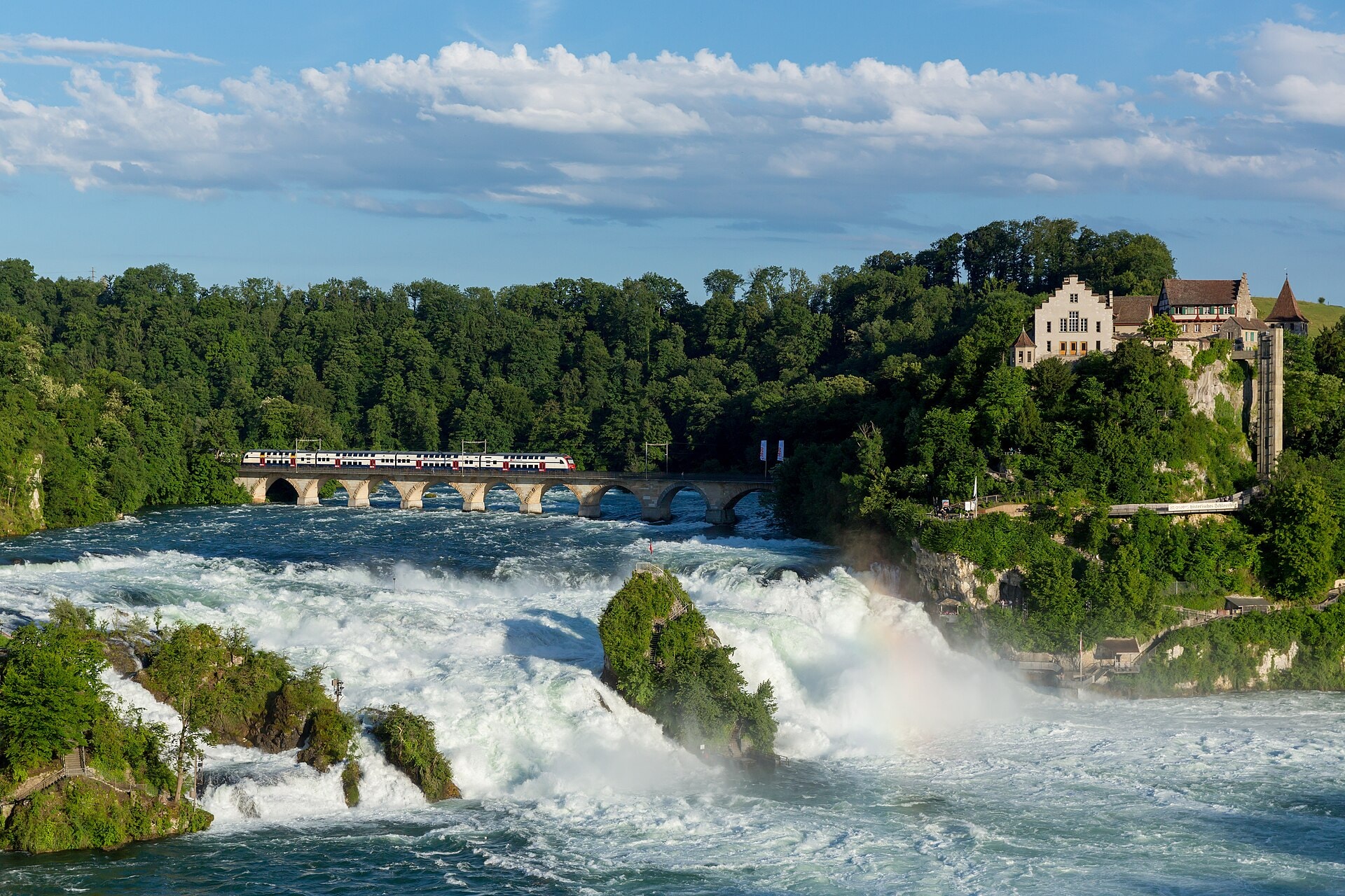
The Via Rhenana is a 189.3 km hiking route crossing the Swiss cantons of Thurgau, Aargau, and Basel-Stadt. The route follows the Rhine and its surroundings, offering a progression through varied landscapes including vineyards, forests, and valleys documented along the trail. The itinerary connects distinct territories by following the course of the river, within a natural and cultural context characteristic of this region in northern Switzerland. The path, waymarked and accessible, constitutes a coherent linear traverse between the starting point in Thurgau and the finish in Basel.
Stages
| Departure | Arrival | Accommodation on arrival | Profile | Duration | Distance | +Elev. | −Elev. |
|---|---|---|---|---|---|---|---|
1 KreuzlingenTown | HaldeVillage | 7h45 | 29.3 km | +559 m | −397 m | ||
2 HaldeVillage | SchaffhausenTown | 6h30 | 27.4 km | +132 m | −307 m | ||
3 SchaffhausenTown | FlaachVillage | 5h15 | 22.9 km | +114 m | −159 m | ||
4 FlaachVillage | LienheimVillage | 5h45 | 23.6 km | +272 m | −282 m | ||
5 LienheimVillage | AlbbruckVillage | 6h15 | 27.4 km | +90 m | −121 m | ||
6 AlbbruckVillage | SchwörstadtVillage | 7h00 | 29.3 km | +222 m | −240 m | ||
7 SchwörstadtVillage | Weil am RheinTown | 7h00 | 29.5 km | +149 m | −186 m |
Elevation profile
How to get there
Public transport
Fully accessibleThe Via Rhenana is accessible by public transport along its entire route. The starting point in Kreuzlingen is served by train from Zurich and Constance, while the finish in Basel has an international railway station connected to Switzerland, France, and Germany.
By car
Explore