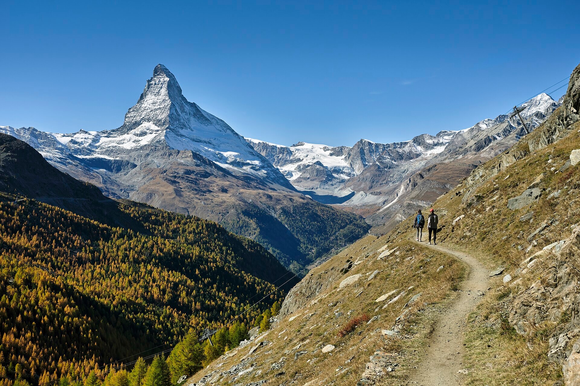
Tour Du Cervin
Photo © Roy Egloff
8-12 days
162.3 km
9128 m
3314 m
The Tour du Cervin is a 162.3 km trek that takes place between Italy (Aosta Valley) and Switzerland (Valais), around the mythical Cervin. The route crosses a succession of documented alpine landscapes: imposing summits, glaciers, deep valleys, cliffs, airy ridges, lakes and forests. The maximum altitude reached is 3,314 metres, offering views characteristic of the Pennine Alps. The trail covers varied terrain, alternating between high-altitude passages and descents into the valleys, with a cumulative positive elevation gain of 9,128 metres. This international trek constitutes a complete traverse of the massifs surrounding the Cervin, between the natural heritage of the Aosta Valley and the Valais.
Stages
| Departure | Arrival | Accommodation on arrival | Profile | Duration | Distance | +Elev. | −Elev. |
|---|---|---|---|---|---|---|---|
1 ValtournencheTown | Le CrêtVillage | 3h30 | 13.8 km | +244 m | −1,349 m | ||
2 Le CrêtVillage | Rifugio PrarayerHut | 5h00 | 12.3 km | +997 m | −1,175 m | ||
3 Rifugio PrarayerHut | Refuge des Bouquetins CASHut | 4h30 | 9 km | +1,094 m | −199 m | ||
4 Refuge des Bouquetins CASHut | Villa (Evolène)Village | 6h00 | 21.9 km | +541 m | −1,702 m | ||
5 Villa (Evolène)Village | Cabane de SoreboisLodge | 7h45 | 17.7 km | +1,763 m | −1,061 m | ||
6 Cabane de SoreboisLodge | Saint-LucVillage | 5h45 | 18.3 km | +754 m | −868 m | ||
7 Saint-LucVillage | GrubenVillage | 3h30 | 10.5 km | +572 m | −1,067 m | ||
8 GrubenVillage | Sankt NiklausVillage | 6h15 | 17.7 km | +1,078 m | −1,751 m | ||
9 Sankt NiklausVillage | FuriHamlet | 5h30 | 19.2 km | +583 m | −0 m | ||
10 FuriHamlet | ZermattTown | — | 8h15 | 21.9 km | +1,572 m | −1,706 m |
Elevation profile
How to get there
Public transport
Fully accessibleThe Tour du Cervin (Matterhorn Tour) is accessible by public transport. The classic starting point of Zermatt is served by train via Viège (Visp), while the variants departing from Saint-Nicolas or Randa are also accessible by the Mattertal railway line. As the route is a loop, it generally ends at its starting point.
By car
Explore