Torres Del Paine Circuit O
Photo © Thomas Fuhrmann
5-7 days
118 km
4188 m
1176 m
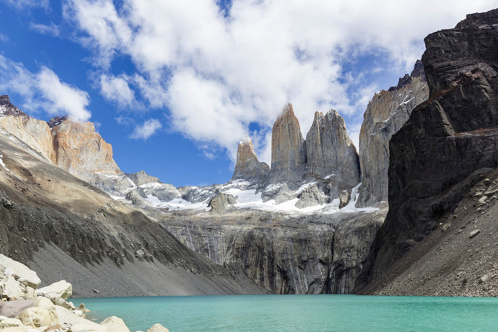
The Torres del Paine Circuit O is a 118 km route located in the Región de Magallanes y de la Antártica Chilena, in Chile. This trail passes through varied and well-documented landscapes: cliffs, lakes, forests, glaciers, peaks, valleys and ridges follow one another throughout the circuit. The route forms a complete loop around the Torres del Paine massif, offering an immersive experience in one of the most remarkable natural environments in Patagonia. The cumulative elevation gain is 4,188 m of ascent and 4,187 m of descent, with a highest point of 1,176 m above sea level.
Stages
| Departure | Arrival | Accommodation on arrival | Profile | Duration | Distance | +Elev. | −Elev. |
|---|---|---|---|---|---|---|---|
1 Torres del PaineTown | Refugio DicksonLodge | 9h00 | 31.9 km | +895 m | −807 m | ||
2 Refugio DicksonLodge | Refugio GreyLodge | 8h30 | 25.9 km | +1,229 m | −1,330 m | ||
3 Refugio GreyLodge | Refugio Vertice Paine GrandeHotel | 2h45 | 10.3 km | +245 m | −320 m | ||
4 Refugio Vertice Paine GrandeHotel | Refugio Los CuernosLodge | 7h15 | 23.4 km | +928 m | −888 m | ||
5 Refugio Los CuernosLodge | Refugio ChilenoHut | 4h00 | 12.1 km | +594 m | −250 m | ||
6 Refugio ChilenoHut | Torres del PaineTown | 4h15 | 14.3 km | +534 m | −829 m |
Elevation profile
How to get there
Public transport
Fully accessibleThe Torres del Paine Circuit O is accessible by public transport to the Torres del Paine national park, but not directly to all trailheads. The classic starting point at Laguna Amarga is reachable by bus from Puerto Natales, followed by a shuttle to the Welcome Center or Hotel Las Torres, where the trek begins. At the end of the circuit, shuttles and buses connect the main sectors of the park to Puerto Natales.
By car
Explore