Shqipëria Veriore·Montenegro, Albania, Kosovo
Peaks Of The Balkans
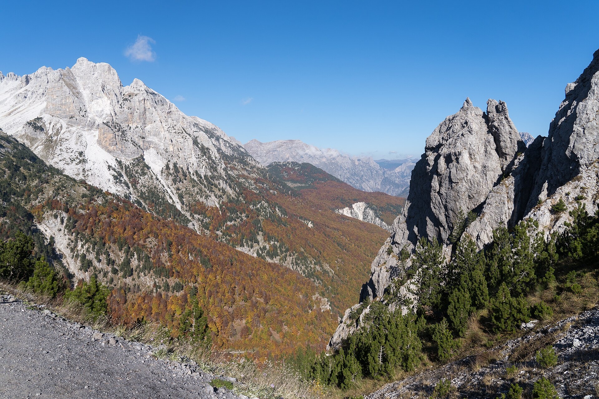
Photo © Alexkom000
Duration
11-17 days
Distance
265.9 km
Elevation gain
11006 m
Max altitude
2247 m
The Peaks of the Balkans is a 265.9 km loop trek crossing three countries: Montenegro, Albania, and Kosovo. The route passes through varied landscapes made up of summits, cliffs, lakes, forests, valleys, caves, and ridges. The trail reaches a maximum altitude of 2,247 m, offering views over the mountainous terrain characteristic of the Western Balkans. This trek is a route that crosses territories with contrasting atmospheres.
SummitsCliffsLakesForestsValleysCavesRidges
Stages
14
days
Overnight accommodation type
53 overnight locations
DifficultyModerate
Duration / day6h00
Distance / day19 km
Elev. gain / day+780 m
Hardest stage
14Ćafa Starac
84.7 km · +2,430 m · 24h15| Departure | Arrival | Accommodation on arrival | Profile | Duration | Distance | +Elev. | −Elev. |
|---|---|---|---|---|---|---|---|
1 Katun BogićevicaHamlet | GradinaHamlet | 3h45 | 14.2 km | +325 m | −1,071 m | ||
2 GradinaHamlet | Vojno SeloVillage | 2h30 | 8.9 km | +233 m | −276 m | ||
3 Vojno SeloVillage | VusanjeTown | 6h00 | 18.4 km | +884 m | −1,047 m | ||
4 VusanjeTown | Okol (Theth)Hamlet | 5h45 | 17.9 km | +811 m | −974 m | ||
5 Okol (Theth)Hamlet | Hotel Fusha e GjesëHotel | 5h30 | 14.7 km | +954 m | −805 m | ||
6 Hotel Fusha e GjesëHotel | ÇeremVillage | 5h30 | 19.4 km | +507 m | −348 m | ||
7 ÇeremVillage | Bujtina LeonardHut | 5h15 | 14.7 km | +914 m | −299 m | ||
8 Bujtina LeonardHut | ZllonopojHamlet | 5h15 | 16.3 km | +738 m | −830 m | ||
9 ZllonopojHamlet | Shtupeq i MadhVillage | 3h30 | 10.5 km | +551 m | −1,198 m | ||
10 Shtupeq i MadhVillage | Hajla Mountain HutHut | 4h15 | 10 km | +874 m | −122 m | ||
11 Hajla Mountain HutHut | KuqishtëVillage | 4h15 | 15.8 km | +377 m | −1,041 m | ||
12 KuqishtëVillage | Debani i MalesoritLodge | 3h15 | 6.8 km | +733 m | −66 m | ||
13 Debani i MalesoritLodge | Triangle WoodhouseLodge | 4h15 | 13.7 km | +595 m | −794 m | ||
14 Triangle WoodhouseLodge | Ćafa StaracPass | — | 24h15 | 84.7 km | +2,430 m | −2,502 m |
Elevation profile
How to get there
Public transport
Fully accessibleThe Peaks of the Balkans is accessible by public transport. The starting point at Theth is served by public minibuses from Shkodër, while the finishing point at Plav is connected by regional buses to the rest of Montenegro.
By car
Explore