Larapinta Trail
Photo © WikiGrats
8-12 days
229.9 km
4758 m
1347 m
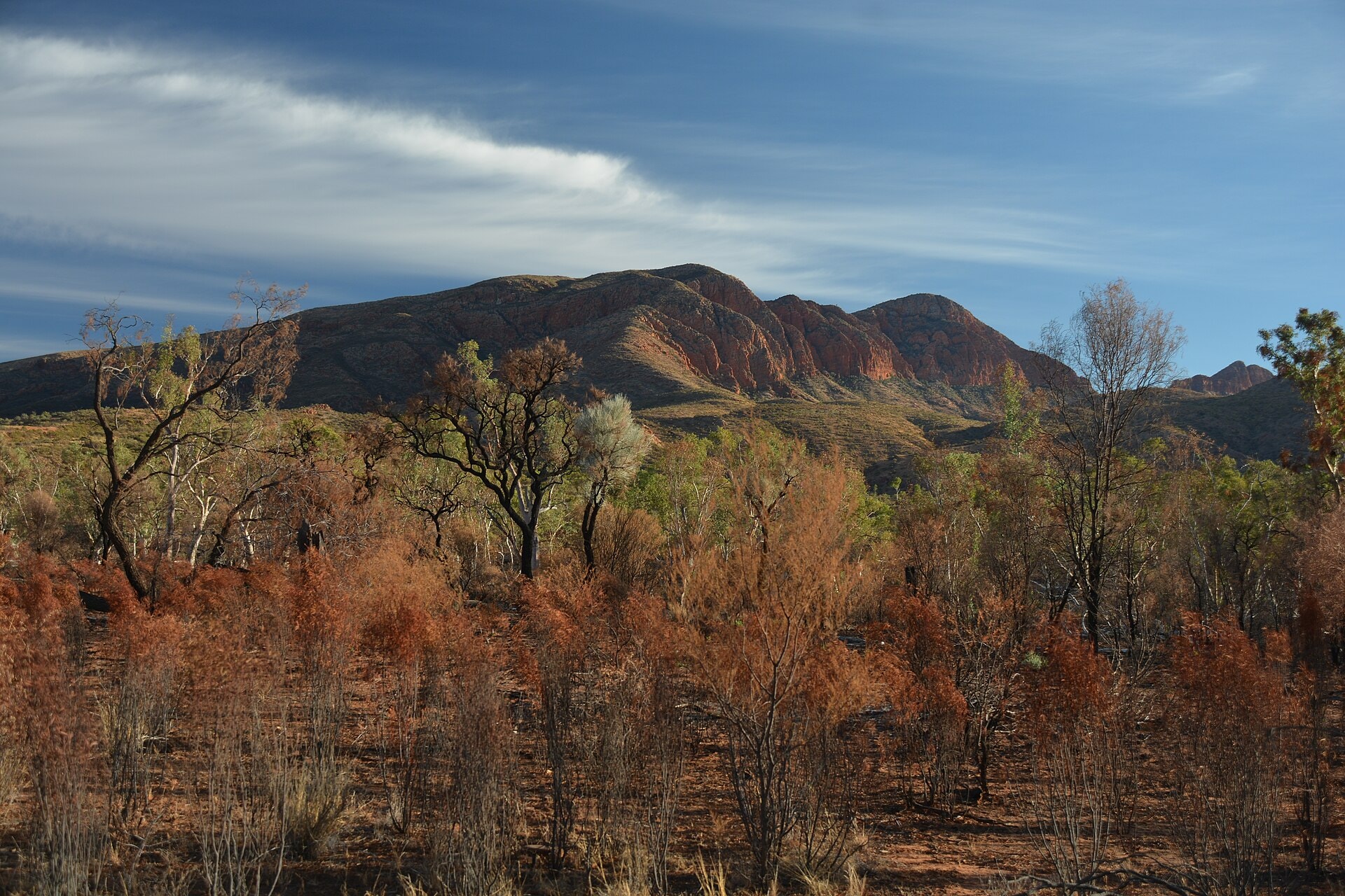
The Larapinta Trail is an iconic route in central Australia, stretching 229.9 km through the West MacDonnell Ranges in the Northern Territory. The trail crosses arid landscapes characteristic of the Australian desert, featuring cliffs, rocky ridges, summits and steep-sided valleys that punctuate the route. The path winds through gorges and rugged terrain, offering an immersive experience in a natural environment of remarkable geological diversity. Reaching a high point of 1,347 m above sea level, it stands as one of Australia's great long-distance walking trails, renowned for the richness of its desert scenery.
Stages
| Departure | Arrival | Accommodation on arrival | Profile | Duration | Distance | +Elev. | −Elev. |
|---|---|---|---|---|---|---|---|
1 Alice SpringsTown | Larapinta Walkers CampsiteBivouac | 6h30 | 24.8 km | +396 m | −370 m | ||
2 Larapinta Walkers CampsiteBivouac | Jay CreekBivouac | 6h30 | 25.2 km | +372 m | −248 m | ||
3 Jay CreekBivouac | bivouacBivouac | 6h00 | 20.3 km | +718 m | −415 m | ||
4 bivouacBivouac | bivouacBivouac | 6h30 | 21.6 km | +708 m | −946 m | ||
5 bivouacBivouac | bivouacBivouac | 6h30 | 26.5 km | +260 m | −375 m | ||
6 bivouacBivouac | bivouacBivouac | 6h30 | 26.1 km | +326 m | −278 m | ||
7 bivouacBivouac | bivouacBivouac | 5h45 | 20.3 km | +588 m | −487 m | ||
8 bivouacBivouac | bivouacBivouac | 6h15 | 23.9 km | +395 m | −564 m | ||
9 bivouacBivouac | Rocky Bar GapCamping | 5h45 | 22 km | +431 m | −412 m | ||
10 Rocky Bar GapCamping | bivouacBivouac | — | 6h00 | 19.3 km | +747 m | −88 m |
Elevation profile
How to get there
Public transport
Fully accessibleThe Larapinta Trail is accessible by public transport as far as Alice Springs, but not directly to the trail's starting points. The classic start at Mount Sonder or the Old Telegraph Station then requires a dedicated shuttle or private transfer.
By car
Explore