Snow-covered trail
RegularSnow-covered trail
50-75% chance
9-13 days
183.6 km
11016 m
2978 m
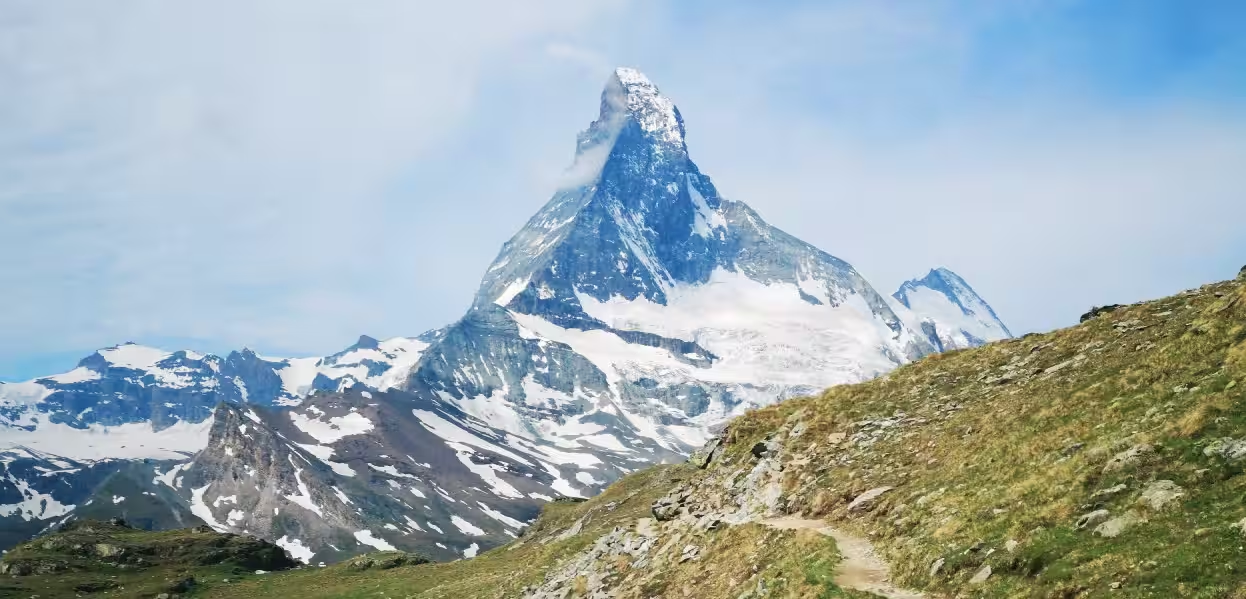
La Haute Route Chamonix – Zermatt est l'une des grandes randonnées itinérantes les plus emblématiques des Alpes. Ce trek alpin de 183 km relie deux capitales de la haute montagne à travers la France et la Suisse, en traversant des cols glaciaires, des alpages sauvages et des vallées spectaculaires.
| Departure | Arrival | Accommodation on arrival | Profile | Duration | Distance | +Elev. | −Elev. |
|---|---|---|---|---|---|---|---|
1 Chamonix-Mont-BlancTown | Refuge du Col de BalmeHut | 6h45 | 17 km | +1,290 m | −97 m | ||
2 Refuge du Col de BalmeHut | ArpetteHamlet | 6h30 | 20 km | +967 m | −1,719 m | ||
3 ArpetteHamlet | Le ChâbleVillage | 4h45 | 17.1 km | +444 m | −899 m | ||
4 Le ChâbleVillage | Cabane Mont FortHut | 6h15 | 11.2 km | +1,699 m | −0 m | ||
5 Cabane Mont FortHut | Cabane de la BarmazHut | 4h45 | 13.7 km | +819 m | −1,134 m | ||
6 Cabane de la BarmazHut | ArollaVillage | 4h15 | 14.4 km | +509 m | −1,098 m | ||
7 ArollaVillage | La Forclaz VSVillage | 5h00 | 9.5 km | +1,273 m | −393 m | ||
8 La Forclaz VSVillage | Cabane de MoiryHut | 3h45 | 11 km | +613 m | −739 m | ||
9 Cabane de MoiryHut | PralongHamlet | 7h15 | 18.3 km | +1,404 m | −1,376 m | ||
10 PralongHamlet | GrubenVillage | 6h00 | 14.4 km | +1,297 m | −1,231 m | ||
11 GrubenVillage | TäschVillage | — | 8h00 | 29.4 km | +676 m | −1,731 m |
Elevation profile
Click a month to view details
Each percentage is the probability of encountering the event at least once during the month, not its intensity or the share of the trail affected. Probabilities are calculated from weather and satellite data* from the last 10 years.
Snow-covered trail
50-75% chance
Cold nights
Minimums around ~ 1°C on high points
Cold nights
Significant rain
5-10% chance
Storm-prone conditions
10-20% chance
Dry conditions
5-10% chance
Snow detail within the month
Early
Regular50-75% chance that the trail is snow-covered
Mid
Frequent25-50% chance that the trail is snow-covered
Late
Rare5-10% chance that the trail is snow-covered
Sources: Open-Meteo and MODIS satellite data.
Public transport
Fully accessibleLa Haute Route Chamonix–Zermatt est facilement accessible sans voiture. L'aller se fait généralement en TGV jusqu'à Genève puis en bus jusqu'à Chamonix (environ 1h15). Au retour, un train relie Zermatt à Visp, puis des correspondances permettent de rejoindre Genève ou Zurich. Les deux extrémités du trek sont très bien desservies par les transports publics suisses et français.
By car
Explore
