Gran Paradiso Grand Tour
Photo © Bramfab
8-12 days
149.1 km
11246 m
3312 m
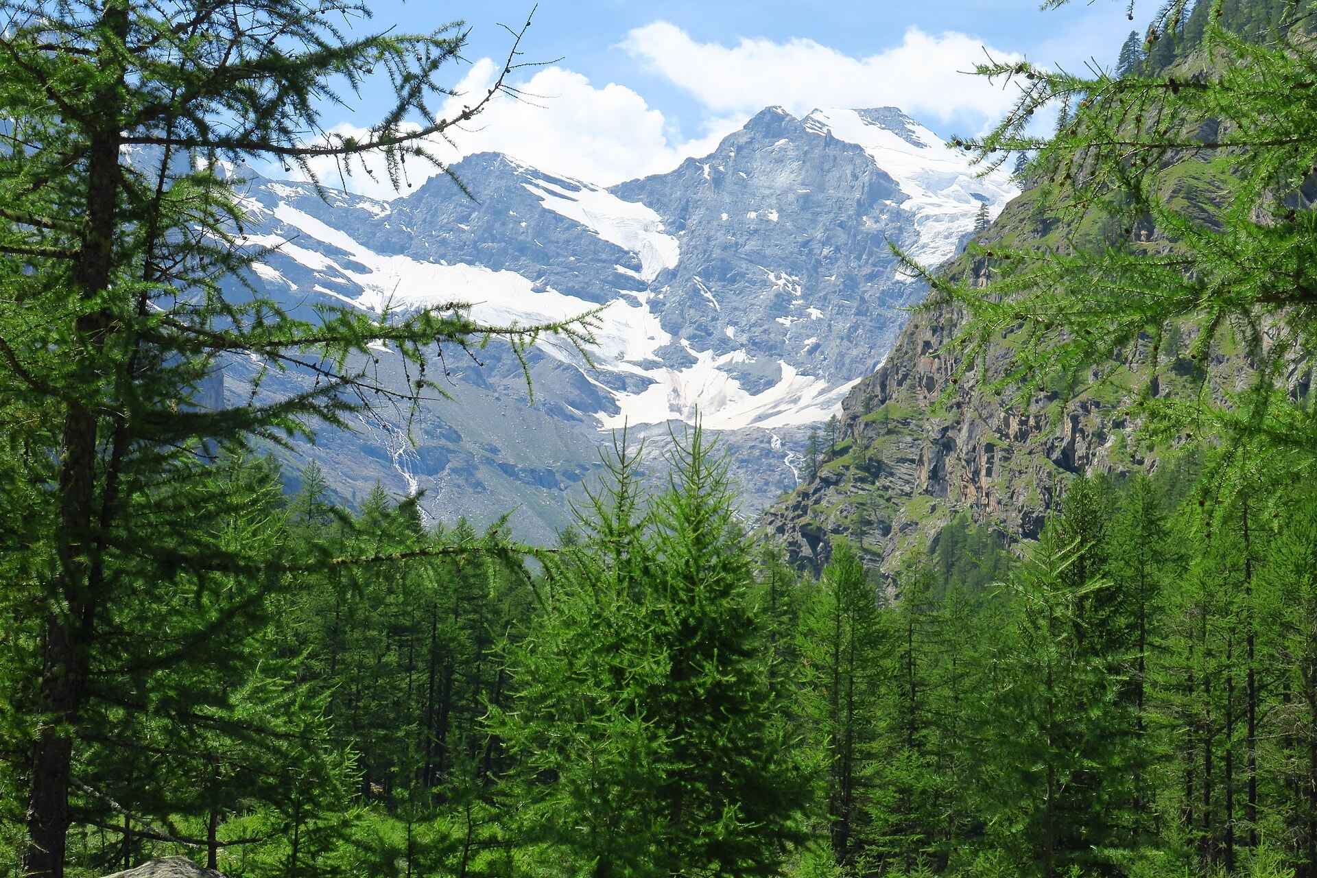
The Gran Paradiso Grand Tour is a 149.1 km route that makes a complete loop around the Gran Paradiso massif, between France and Italy, crossing the Auvergne-Rhône-Alpes, Vallée d'Aoste and Piedmont regions. The route links summits, ridges, valleys, cliffs, forests, glaciers and lakes at the heart of an exceptional Alpine territory, reaching a maximum altitude of 3,312 metres. The itinerary unfolds varied and contrasting landscapes, alternating high-altitude passages with descents into valley floors throughout the entire route. This complete tour represents a full immersion in the natural environment of the highest summit located entirely in Italy and its eponymous national park.
Stages
| Departure | Arrival | Accommodation on arrival | Profile | Duration | Distance | +Elev. | −Elev. |
|---|---|---|---|---|---|---|---|
1 Sainte-Foy-TarentaiseTown | Les UsellièresHamlet | 5h15 | 12.7 km | +1,108 m | −804 m | ||
2 Les UsellièresHamlet | Rhêmes-Notre-DameVillage | 5h15 | 13.2 km | +1,047 m | −1,115 m | ||
3 Rhêmes-Notre-DameVillage | Camping GrivolaCamping | 6h30 | 15.9 km | +1,283 m | −1,433 m | ||
4 Camping GrivolaCamping | Rifugio Vittorio SellaHut | 7h00 | 14.6 km | +1,690 m | −699 m | ||
5 Rifugio Vittorio SellaHut | Bivacco Antoldi - MalvezziHut | 7h00 | 19 km | +1,289 m | −1,073 m | ||
6 Bivacco Antoldi - MalvezziHut | Bivacco IvreaHut | 5h45 | 11.8 km | +1,436 m | −1,491 m | ||
7 Bivacco IvreaHut | Bivacco GiraudoHut | 4h45 | 14.3 km | +745 m | −858 m | ||
8 Bivacco GiraudoHut | Rifugio SavoiaHut | 5h00 | 14.6 km | +807 m | −838 m | ||
9 Rifugio SavoiaHut | Rifugio Mario BezziHut | 7h15 | 19.5 km | +1,258 m | −1,580 m | ||
10 Rifugio Mario BezziHut | L'EchaillonHamlet | 4h15 | 13.5 km | +550 m | −1,143 m |
Elevation profile
How to get there
Public transport
Fully accessibleThe Gran Paradiso Grand Tour is accessible by public transport. The classic starting point at Pont (Valsavarenche) is reached by train to Aoste, then by regional bus towards Valsavarenche. As the itinerary is a loop, it ends at the same point, which simplifies logistics. The valleys crossed, such as Cogne, Valsavarenche and Rhêmes, are also served by regional buses, making it possible to join or leave the route at various stages.
By car
Explore