Bayern, Hessen, Thüringen·Germany
Der Hochrhoner
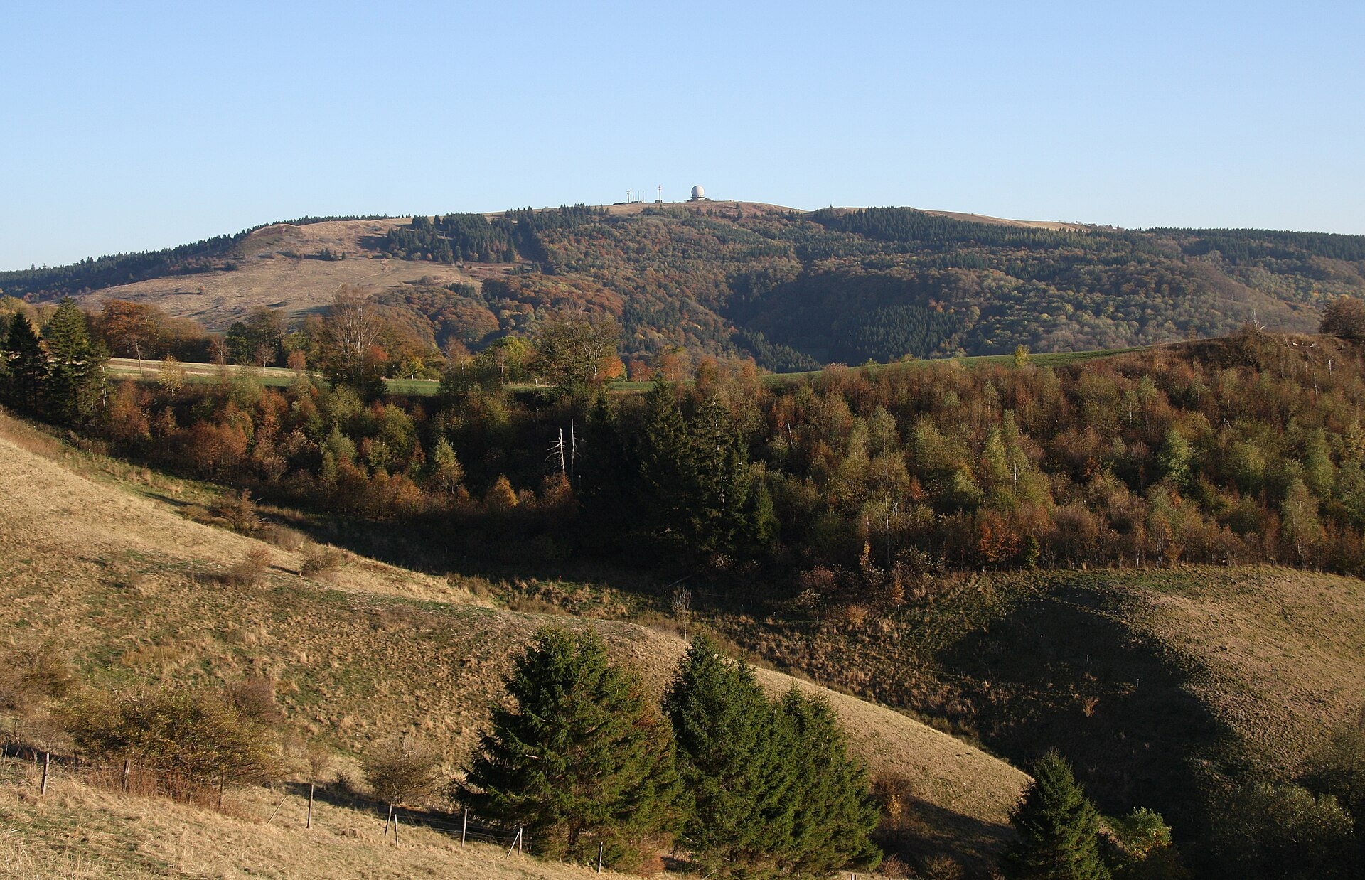
Photo © GerritR
Duration
9-14 days
Distance
292.4 km
Elevation gain
4187 m
Max altitude
937 m
Der Hochrhoner is a long-distance trek of 292.4 km crossing three German regions: Bavaria, Hesse, and Thuringia. The route winds through varied landscapes characterised by forests, lakes, summits, cliffs, ridges, and caves. The highest point of the trail reaches an altitude of 937 metres. This trail offers a gradual crossing of central Germany, connecting diverse natural environments throughout its entire route.
SummitsLakesForestsCliffsRidgesCaves
Stages
12
days
Overnight accommodation type
55 overnight locations
DifficultyDifficult
Duration / day6h15
Distance / day24.4 km
Elev. gain / day+357 m
Hardest stage
12Gersfeld
44 km · +788 m · 11h30| Departure | Arrival | Accommodation on arrival | Profile | Duration | Distance | +Elev. | −Elev. |
|---|---|---|---|---|---|---|---|
1 Bad KissingenTown | PremichVillage | 4h15 | 16.1 km | +330 m | −242 m | ||
2 PremichVillage | Bischofsheim in der RhönTown | 4h30 | 14.4 km | +597 m | −180 m | ||
3 Bischofsheim in der RhönTown | ReulbachVillage | 5h00 | 17.8 km | +507 m | −309 m | ||
4 ReulbachVillage | GotthardsVillage | 5h30 | 21.9 km | +250 m | −702 m | ||
5 GotthardsVillage | AndenhausenVillage | 7h00 | 24.1 km | +735 m | −614 m | ||
6 AndenhausenVillage | BernshausenVillage | 5h45 | 20.7 km | +531 m | −702 m | ||
7 BernshausenVillage | Bad SalzungenTown | 4h30 | 17.3 km | +249 m | −395 m | ||
8 Bad SalzungenTown | KaltensundheimVillage | — | 5h00 | 23 km | +0 m | −17 m | |
9 KaltensundheimVillage | BurgwallbachVillage | 6h15 | 27.6 km | +0 m | −20 m | ||
10 BurgwallbachVillage | Haus ErnaLodge | 6h15 | 27.6 km | +45 m | −22 m | ||
11 Haus ErnaLodge | Ferienhaus GeißberghausLodge | 9h00 | 38 km | +256 m | −0 m | ||
12 Ferienhaus GeißberghausLodge | GersfeldTown | — | 11h30 | 44 km | +788 m | −434 m |
Elevation profile
How to get there
Public transport
Fully accessibleDer Hochrhöner is accessible by public transport. The official starting point at Bad Kissingen is served by train from Würzburg and Fulda, while the endpoint at Bad Salzungen has a railway station connected to the German rail network.
By car
Explore