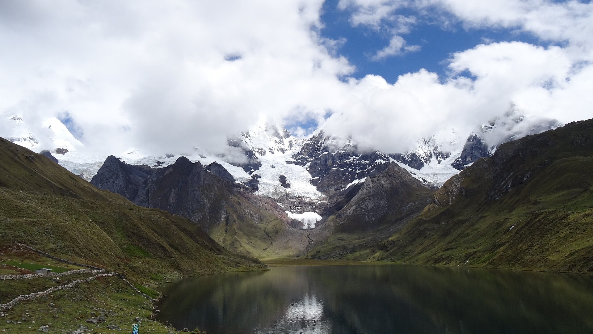
Cordillera Huayhuash
Photo © Gato Expedicionario 1883
5-8 days
112.2 km
6808 m
5019 m
The Cordillera Huayhuash is a 112.2 km circuit located in Peru, spanning the regions of Ancash, Lima, and Huánuco. The route crosses high-mountain landscapes characteristic of the Peruvian Andes, with snow-capped peaks, glaciers, high-altitude lakes, ridges, and forested areas. The highest point of the route reaches 5,019 metres in altitude, offering a deep immersion into one of the most remote massifs in Peru. The trek follows a loop and travels through varied environments, alternating between valleys, passes, and glacial surroundings throughout the circuit.
Stages
| Departure | Arrival | Accommodation on arrival | Profile | Duration | Distance | +Elev. | −Elev. |
|---|---|---|---|---|---|---|---|
1 LlamacTown | campingCamping | 4h30 | 8.4 km | +1,129 m | −526 m | ||
2 campingCamping | Camp HuatiaqCamping | 6h00 | 15.6 km | +1,185 m | −920 m | ||
3 Camp HuatiaqCamping | Campamento ElefanteCamping | 6h00 | 17.4 km | +942 m | −775 m | ||
4 Campamento ElefanteCamping | Campamento HuayhuashCamping | 6h15 | 18.4 km | +1,013 m | −1,166 m | ||
5 Campamento HuayhuashCamping | CarhuacochaCamping | 4h15 | 14 km | +555 m | −747 m | ||
6 CarhuacochaCamping | CampamentoBivouac | 6h30 | 20.2 km | +924 m | −1,049 m | ||
7 CampamentoBivouac | LlamacTown | — | 6h45 | 18.2 km | +1,234 m | −1,802 m |
Elevation profile
How to get there
Public transport
Fully accessibleThe most common access point is Huaraz, served by long-distance buses from Lima. From Huaraz, buses or colectivos allow you to reach villages such as Chiquián, Llamac, Pocpa, or Cuartelhuain, which serve as starting points depending on the chosen variant. At the end of the trek, it is possible to take a colectivo or a bus back to Huaraz from these same villages.
By car
Explore